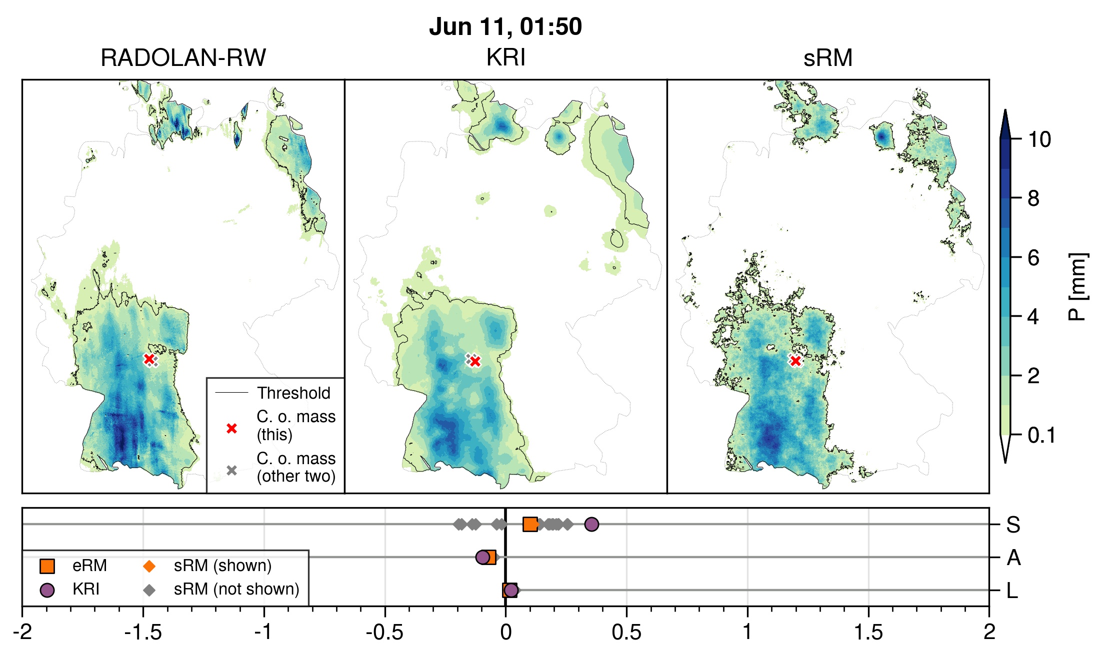
Commercial microwave links have been used to estimate large-scale rainfall maps in several studies. Recently, this topic was approached again with a new focus on spatial rainfall patterns, which resulted in a publication by Nico Blettner and colleagues from Karlsruhe Institute of Technology, (Campus Alpin), University of Augsburg, and University of Queensland. In this study, the authors used observations from both commercial microwave links and rain gauges to estimate country-wide rainfall maps for Germany. They applied a method of stochastic reconstruction which accounts for the integral character of the commercial microwave links and enables the assessment of uncertainties via the generation of ensembles of solutions. Their results show benefits of the methodology over standard methods with respect to the challenging task of representing the spatial patterns of rainfall.
The figure shows an example of a reconstructed map (right), a map created by a standard “Kriging” method (center), and the map derived from rain gauge-adjusted weather radar of the German Weather Service that served as a reference (left). Below, the so-called SAL metrics quantify aspects of the rainfall pattern and show good performance by values that are close to zero.
For further information, have a look at the article:
https://doi.org/10.1029/2022WR032563